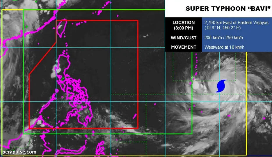
Super Typhoon Bavi has intensified further, with maximum sustained winds of 205 kilometers per hour as of July 4, 2026. The Philippine Atmospheric, Geophysical, and Astronomical Services Administration (PAGASA) reports that Bavi's gustiness has reached 250 km/h.
Projected Path and Local Impact
Currently located 2,790 kilometers east of Eastern Visayas, Bavi is moving towards the Philippine Area of Responsibility (PAR) at a speed of 10 km/h. PAGASA expects the super typhoon to enter PAR by Wednesday, July 8.
Tropical cyclone wind signals could be raised for portions of Northern Luzon immediately after Bavi’s entry.
Daniel James Villamil, PAGASA Weather Specialist
Villamil indicated that Signal Nos. 2 or 3 might be issued, with the potential for Signal No. 4 in Batanes, indicating severe threats to life and property.
While Bavi is less likely to make landfall in the Philippines, it could approach Northern Luzon or Batanes. The typhoon may also affect Taiwan, located north of Batanes.
In addition, Bavi is expected to enhance the southwest monsoon or *habagat*, potentially resulting in widespread rainfall across the western Philippines, including Metro Manila, in the latter half of the week.
This situation draws some parallels to Super Typhoon Carina in July 2024, which, while making landfall in Taiwan, significantly impacted Northern Luzon and contributed to severe flooding in Metro Manila.
Residents are advised to stay informed and prepared as the situation evolves. Continuous updates from PAGASA will be critical in the coming days.