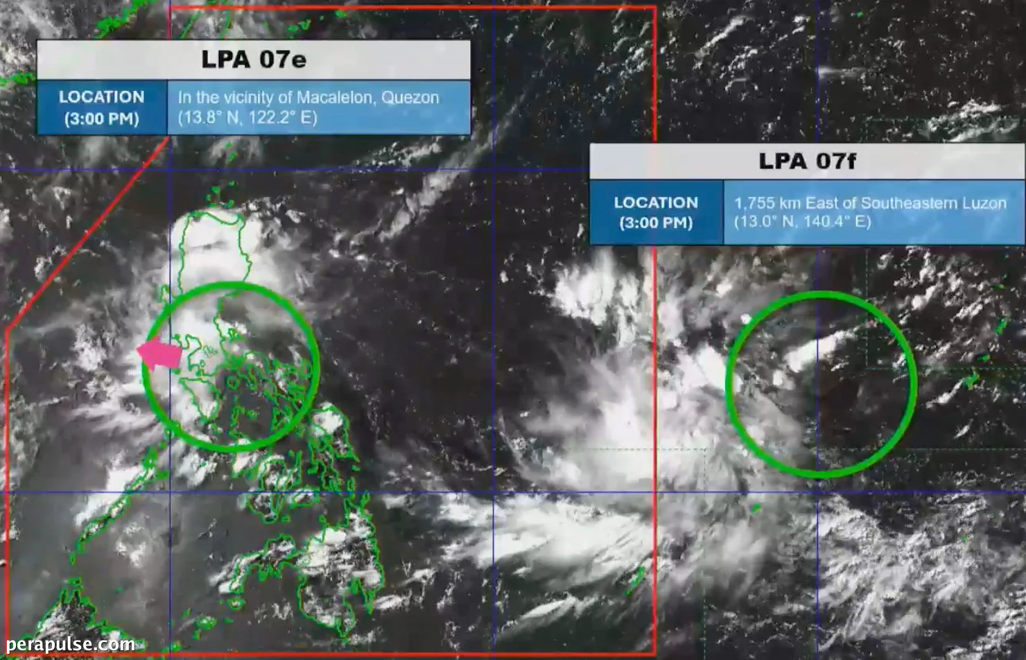
Isang low pressure area (LPA) ang kasalukuyang nakaapekto sa Timog Luzon, nagdadala ng mga nakakalat na ulan at thunderstorms sa buong rehiyon. Ang Philippine Atmospheric, Geophysical and Astronomical Services Administration (PAGASA) ay nag-ulat na ang sistemang pangpanahon na ito ay nagbigay-daan sa mga babala para sa flash floods at landslides.
Weather Update at Forecast
Inaasahang patuloy na gagalaw ang LPA patungong kanluran hilagang-kanluran at maaaring mawala sa West Philippine Sea sa madaling araw ng Huwebes.
(cite: Benison Estareja, PAGASA Weather Specialist)
Ang LPA ay nabuo noong Hulyo 28 mula sa mga ulap at inaasahang makakaapekto sa mga lugar kabilang ang Metro Manila, Calabarzon, at mga bahagi ng Bicol at Western Visayas. Ipinapakita ng forecast na ang localized thunderstorms ay maaaring magpatuloy sa buong araw, na nakaapekto sa mga lugar na hindi tuwirang nabanggit sa ulat.
Bilang karagdagan sa LPA, may isa pang sistema na minomonitor sa labas ng Philippine Area of Responsibility, na matatagpuan 1,755 kilometro mula sa timog-silangang Luzon. Ang pangalawang LPA na ito ay hindi inaasahang papasok sa PAR o magiging tropical depression.
Binibigyang-diin ng PAGASA ang kahalagahan ng pagiging updated sa nagbabagong kondisyon ng panahon, lalo na't isinasalang-alang ang potensyal para sa localized rain habang umuusad ang mga epekto ng LPA.