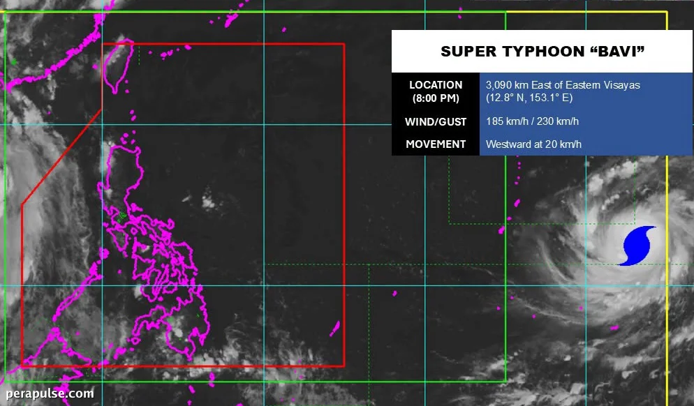
The Philippine Atmospheric, Geophysical, and Astronomical Services Administration (PAGASA) reported that Bavi has transformed from a typhoon into a super typhoon, boasting maximum sustained winds of 185 kilometers per hour.
As of July 3, 2026, the storm was located about 3,090 kilometers east of Eastern Visayas, advancing westward at 20 km/h.
Forecasts and Potential Impact
PAGASA predicts that Bavi could enter the Philippine Area of Responsibility (PAR) by July 8, where it will receive the local name Inday.
Bavi underwent 'explosive intensification over the past 12 hours,' according to the Japan Meteorological Agency.
Japan Meteorological Agency
- Maximum sustained winds: 185 km/h
- Gustiness: 230 km/h
- Current distance from Eastern Visayas: 3,090 km
Although it remains uncertain how close Bavi will come to the Philippines, PAGASA has warned that the super typhoon could impact Northern Luzon and possibly Taiwan.
The storm's trajectory is reminiscent of Super Typhoon Carina in July 2024, which, despite making landfall in Taiwan, caused significant flooding in parts of Luzon.
As Bavi approaches, it is expected to enhance the southwest monsoon, bringing heavy rainfall starting July 9, with potential flooding and landslides.
Residents are encouraged to stay updated with PAGASA's forecasts as the situation evolves.