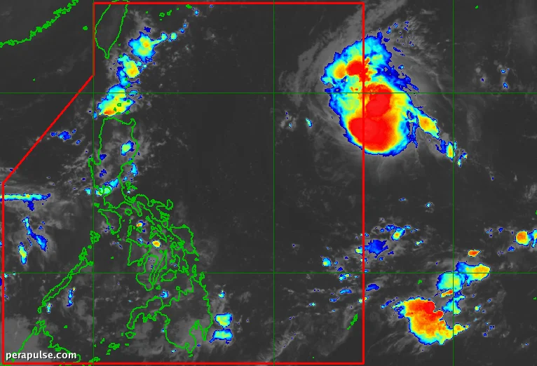
Tropical Storm Surigae is on track to enter the Philippine Area of Responsibility (PAR) early on September 24, 2026. This storm will be named Queenie once it crosses into the region.
Storm Development and Current Status
Surigae intensified from a tropical depression on September 23, originating from a low-pressure area detected on September 22. As of 3 AM on September 24, PAGASA reported that it was located approximately 1,500 kilometers east of Northern Luzon.
Surigae is moving west-northwest at 30 kilometers per hour, with sustained winds of 75 km/h and gusts reaching 90 km/h.
Philippine Atmospheric, Geophysical, and Astronomical Services Administration (PAGASA)
- Projected to continue west-northwest until September 25.
- Expected to turn northwest on September 26 and north by September 28.
- May strengthen to typhoon status by September 27.
PAGASA has indicated that while Surigae is unlikely to make landfall, its trough will cause scattered rain and thunderstorms across several areas.
Regions including Biliran, Leyte, and parts of Eastern Visayas are expected to experience these weather disturbances.
The rest of the country may encounter localized thunderstorms, with the eastern seaboard of Northern Luzon experiencing moderate waters as Surigae approaches.