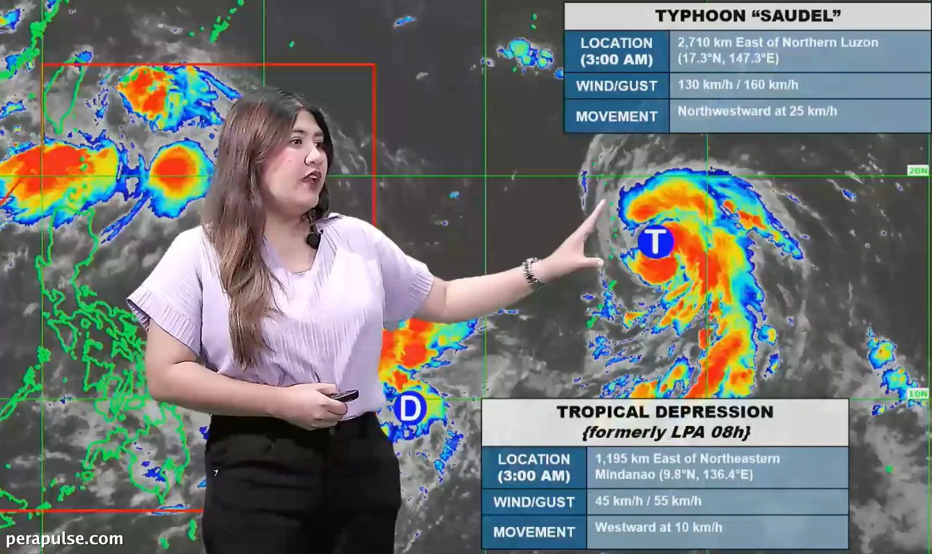
Typhoon Saudel has officially intensified into a typhoon, having transitioned from a severe tropical storm late Friday, August 21. Meanwhile, a low pressure area (LPA) has developed into a tropical depression early Saturday, August 22, both situated outside the Philippine Area of Responsibility (PAR).
According to the Philippine Atmospheric, Geophysical, and Astronomical Services Administration (PAGASA), as of 3 AM on Saturday, Saudel was located approximately 2,710 kilometers east of Northern Luzon, moving northwest at a speed of 25 kilometers per hour (km/h). Its sustained winds are reported at 130 km/h, with gusts reaching up to 160 km/h.
Impending Weather Impact
Saudel is expected to enter PAR by Monday, August 24, which could lead to significant rainfall across Luzon as it enhances the southwest monsoon, or *habagat*. This rain may result in flash floods and landslides in vulnerable areas.
Currently, the southwest monsoon is already affecting multiple regions, including the Ilocos Region, the Cordillera Administrative Region, and parts of Central Luzon. Scattered rain and thunderstorms are prevalent, with warnings for potential heavy rain.