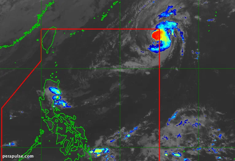
Typhoon Samuel, internationally named Cempaka, entered the Philippine Area of Responsibility (PAR) at 8:40 AM on November 9, 2026. Despite its entry, the Philippine Atmospheric, Geophysical, and Astronomical Services Administration (PAGASA) reports that it will not significantly affect the country.
Current Status and Forecast
As of 10 AM, Samuel was located approximately 1,370 kilometers east-northeast of extreme Northern Luzon, moving at a speed of 20 kilometers per hour. The typhoon has maximum sustained winds of 120 km/h, with gusts reaching 150 km/h.
Samuel may strengthen further, potentially reaching maximum sustained winds of 150 km/h by Tuesday morning, but it is expected to weaken shortly after.
PAGASA
Currently, the northeast monsoon is influencing weather patterns across the Philippines, bringing rains to several areas, while the easterlies contribute additional precipitation.
PAGASA also warned of strong to gale-force gusts affecting many areas, with rough sea conditions posing risks to maritime activities.
Northeast Monsoon Effects
The northeast monsoon is expected to bring rough seas, particularly along the northern seaboard of Batanes, where wave heights could reach up to 5.5 meters, making travel dangerous.
Despite the presence of El Niño, which typically reduces rainfall, weather experts note that tropical cyclones can still enter PAR, and their intensity can still vary significantly.