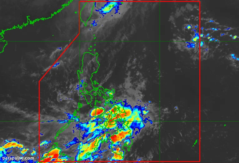
Typhoon Rosal, internationally known as Champi, officially exited the Philippine Area of Responsibility (PAR) on Saturday morning, October 24, leaving behind a trail of wet weather.
Rosal peaked as a super typhoon with maximum sustained winds of 215 kilometers per hour but weakened to 120 km/h upon exit. Although it did not make landfall, it brought significant rainfall and wind to Northern Luzon, particularly affecting Batanes.
Lingering Effects of Typhoon Rosal
The Philippine Atmospheric, Geophysical, and Astronomical Services Administration (PAGASA) indicated that the storm's trough is still influencing weather patterns, leading to scattered rain and thunderstorms.
Scattered rain and thunderstorms due to Rosal’s trough will be confined to Batanes, Ilocos Norte, Apayao, and Babuyan Islands in the coming hours.
PAGASA
As Rosal moves away, the intertropical convergence zone (ITCZ) is expected to bring rain and thunderstorms to the Visayas, Mindanao, Sorsogon, Masbate, and Palawan. Residents in these areas should remain vigilant for possible flash floods and landslides.
The ITCZ forms a belt near the equator where trade winds from both hemispheres meet, often leading to increased precipitation.
The Philippines is currently transitioning from the southwest monsoon, which ended on October 5, to the northeast monsoon. This period typically brings cooler temperatures, but current predictions indicate that the upcoming amihan could be warmer due to the ongoing El Niño phenomenon.