Pumasok na ang Tropical Depression Ester sa Philippine Area of Responsibility (PAR), pinatitindi ang kondisyon ng panahon sa Batanes. Ang sistemang ito, ang ikalimang tropical cyclone ng taon, ay nabuo noong umaga ng Hunyo 5.
Kasalukuyang Sitwasyon sa Batanes
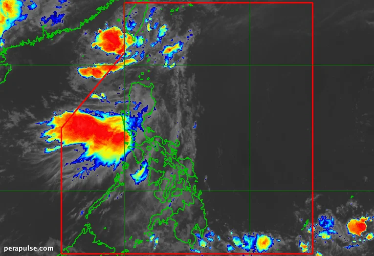
Noong 10 a.m. ng Hunyo 5, ang Ester ay nasa humigit-kumulang 230 kilometro hilagang-kanluran ng Itbayat, Batanes, at kumikilos patungong hilagang-silangan sa bilis na 15 kilometro bawat oras.
Nakakaranas ang Batanes ng katamtaman hanggang malakas na pag-ulan at matinding hangin dahil sa Tropical Depression Ester.
(source: PAGASA)
Sa ilalim ng Signal No. 1 mula 5 a.m. ng Biyernes, pinapayuhan ang mga residente tungkol sa malalakas na hangin at ang posibilidad ng pagbaha at pagguho ng lupa.
Mas Malawak na Epekto ng Panahon
Pinatitindi rin ni Ester ang southwest monsoon, na inaasahang magdadala ng ulan sa iba't ibang rehiyon, kabilang ang mga bahagi ng Northern at Central Luzon.
Bilang karagdagan sa malakas na pag-ulan, ang malalakas na hangin ay makakaapekto sa ilang mga lugar, kabilang ang Metro Manila at mga bahagi ng Luzon.
Mga Hakbang sa Kaligtasan
Pinapayuhan ang mga residente na maging mapagmatyag dahil ang mga kondisyon ay maaaring magdulot ng magaspang na dagat, partikular sa kanlurang baybayin ng Batanes at mga Pulo ng Babuyan.
Inaasahang lalabas si Ester sa PAR sa maagang bahagi ng Hunyo 6, na maaaring lumakas bilang isang tropical storm sa ibabaw ng East China Sea.