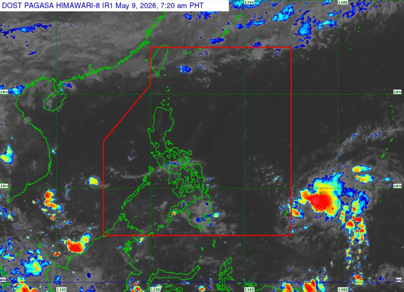
Tropical Storm Hagupit is predicted to lose strength as it approaches the Philippine Sea, according to the Philippine Atmospheric, Geophysical, and Astronomical Services Administration (Pagasa).
In its 5 a.m. update, Pagasa confirmed that Hagupit is expected to enter the Philippine Area of Responsibility (PAR) today, where it will be renamed Caloy.
Currently located approximately 1,165 kilometers east of Northern Mindanao, Hagupit is packing winds of up to 75 kilometers per hour (kph) and gusts reaching 20 kph. It is moving westward at a speed of 20 kph.
Weather specialist Loriedin de la Cruz-Galicia noted that the storm's trajectory suggests it will weaken significantly. "There is a high chance that it will weaken once it reaches the Philippine Sea," she stated.
Hagupit is forecasted to transition into a low pressure area (LPA) by May 13, which may still bring rain to the eastern sections of Visayas and parts of Southern Luzon.
In the meantime, warm easterly winds are affecting the country, resulting in partly cloudy to cloudy skies over Luzon and Visayas, while localized thunderstorms are expected in Mindanao.
Pagasa also reported that there are no gale warnings in effect across any coastal areas.
Temperature Forecast
Pagasa has released the following temperature forecasts for select areas:
- Laoag: 26°C to 34°C
- Baguio: 18°C to 27°C
- Metro Manila: 27°C to 36°C
- Tagaytay: 23°C to 32°C
- Tuguegarao: 26°C to 39°C
- Legazpi: 26°C to 33°C
- Kalayaan Islands: 26°C to 32°C
- Puerto Princesa: 26°C to 32°C
- Iloilo: 26°C to 32°C
- Cebu: 28°C to 33°C
- Tacloban: 26°C to 33°C
- Cagayan de Oro: 26°C to 32°C
- Davao: 26°C to 35°C
- Zamboanga: 26°C to 34°C