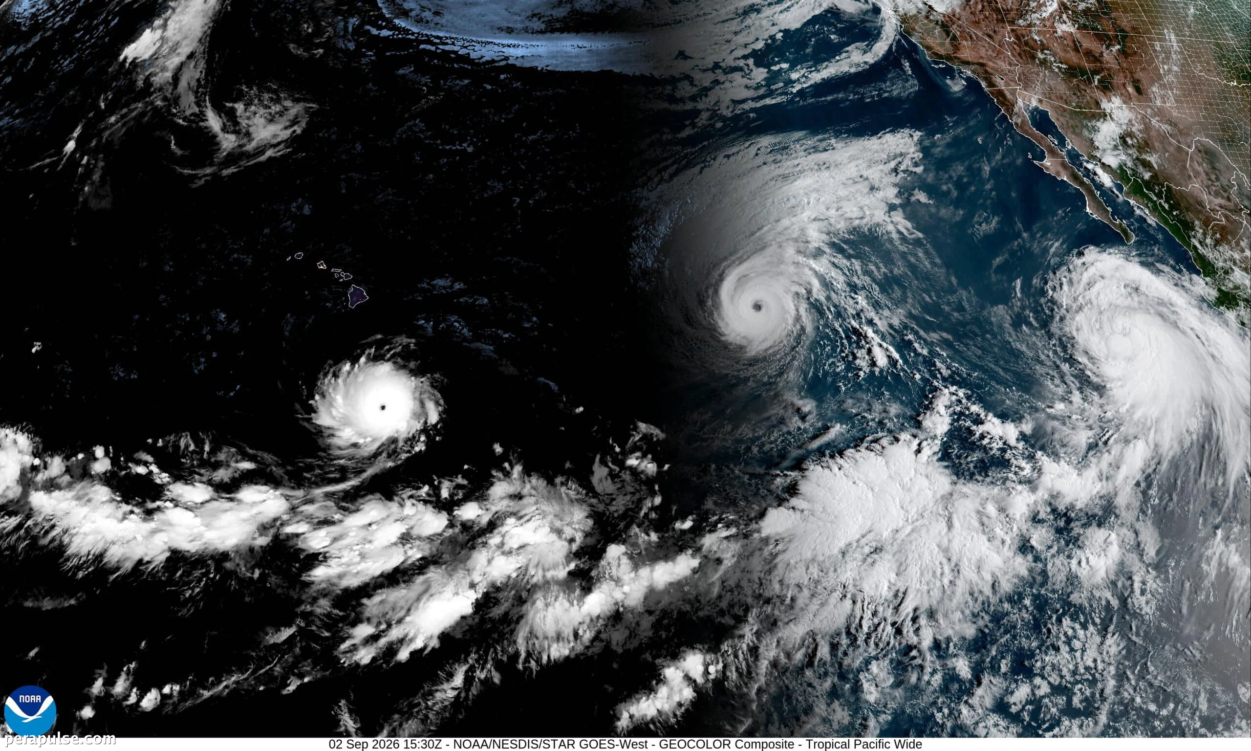
Three cyclones are currently active in the Pacific, driven by a historically strong El Niño event. Hurricane Lowell and Hurricane Karina, both Category 4 storms, are positioned far from Hawaii but pose potential threats.
Potential Threats to Hawaii
The National Hurricane Center indicates that while the storms are expected to pass south and northeast of the Hawaiian Islands, there is still uncertainty regarding their paths. Lowell may approach the westernmost islands.
Hawaii is still recovering from Hurricane Lala, which caused significant damage and flooding in August.
El Niño warming sets the stage for these storms, which are fueled in large part by warm waters — when the tropical Pacific is warmer than normal we see an increase in strong storms.
Julia Cole, Climate Scientist
- Hurricane Lowell: Category 4
- Hurricane Karina: Category 4
- Tropical Storm Marie: Strengthening to hurricane
Tropical Storm Marie follows behind the two hurricanes, currently located south of Baja California. It is anticipated to become a hurricane soon, according to forecasts.
Climate experts note that this unusual occurrence of three cyclones is rare. Julia Cole highlights that such formations are linked to El Niño, which significantly warms ocean temperatures, creating ideal conditions for storm development.
Historically, a similar event occurred in 2015 during another strong El Niño year, when four cyclones were simultaneously active in the Pacific.
Benjamin Kirtman from the University of Miami emphasizes that the current state of the Pacific is conducive to storm formation due to minimal vertical wind shear.
The National Oceanic and Atmospheric Administration reports a 69 percent chance that this year's El Niño could become the strongest on record, amplifying its global weather impacts.
The effects of El Niño are already being felt worldwide, with Peru's anchovy production severely impacted by warmer seas and Sudan facing delayed rains affecting the Nile.