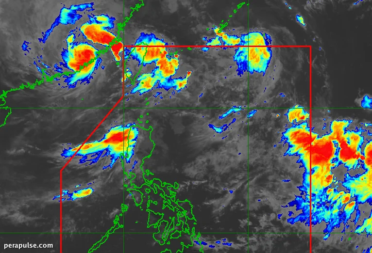
Tropical Storm Pilandok ay opisyal na umalis sa Philippine Area of Responsibility (PAR) noong Setyembre 3, 2026. Ang bagyo ay naitala sa 4:30 AM, na matatagpuan humigit-kumulang 1,050 kilometro hilagang-silangan ng Northern Luzon.
Sa kabila ng pag-alis nito, ang mga epekto ng southwest monsoon ay nagpapatuloy, kung saan nagbigay ng babala ang PAGASA ng katamtaman hanggang sa malakas na pag-ulan sa ilang mga probinsya sa Luzon sa susunod na 72 oras.
Taya ng Ulan at Mga Apektadong Lugar
Pinapayuhan ang mga residente sa mga lugar na ito na manatiling mapagmatyag habang nagpapatuloy ang panganib ng pagbaha at pagguho ng lupa. Ang southwest monsoon ay nagdudulot din ng malakas hanggang sa gale-force na hangin sa karamihan ng Luzon at ilang bahagi ng Visayas.
Kasalukuyan at Hinaharap na Mga Pattern ng Panahon
Habang inaasahang mapanatili ni Pilandok ang katayuan nito bilang tropical storm habang papunta ito sa timog ng Japan, inaasahang mananatili itong nakatigil sa loob ng ilang araw dahil sa impluwensya ng isang high-pressure area.
Binabantayan din ng PAGASA ang isa pang tropical storm, si Obet, at isang low-pressure area sa labas ng PAR. Habang umaalis si Obet sa PAR, ito rin ay nagpapalakas sa southwest monsoon.
Historically, ang Pilipinas ay nakakaranas ng average na 20 tropical cyclones bawat taon. Ang presensya ni Pilandok ay nagpapakita ng ika-16 na tropical cyclone para sa taong ito, na lumalampas sa mga forecast para sa Agosto.