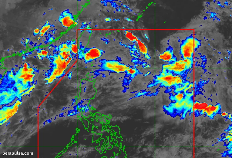
Tropical Storm Pilandok (Krovanh) is forecasted to leave the Philippine Area of Responsibility (PAR) early on September 3, 2026. Currently situated approximately 1,085 kilometers east-northeast of extreme Northern Luzon, the storm is moving west-northwest at 14 kilometers per hour.
Impact of Pilandok on Local Weather Patterns
As Pilandok enhances the southwest monsoon, it is causing moderate to heavy rainfall across many provinces in Luzon and the Visayas. PAGASA has issued warnings for potential flooding and landslides, particularly in areas like Ilocos Norte, Ilocos Sur, and Bataan.
The southwest monsoon is expected to result in heavy to intense rain in the coming days, with warnings for floods and landslides in affected provinces.
PAGASA Weather Specialist Benison Estareja
The storm is not expected to make landfall, remaining over the northern Philippine Sea as it tracks towards Okinawa, Japan. Meanwhile, Tropical Storm Saudel, located 460 kilometers west-northwest of Itbayat, Batanes, is gradually weakening as it moves toward southern China.
PAGASA is also monitoring another low-pressure area (LPA) about 2,745 kilometers east of Central Luzon, though it currently has a low chance of developing into a tropical depression.
Coastal Warnings and Air Quality Alerts
In addition to heavy rainfall, the southwest monsoon is generating strong to gale-force winds across coastal regions, impacting the safety of maritime activities.
Haze from wildfires in Indonesia is also affecting air quality, particularly in parts of the Visayas and Mindanao. PAGASA advises residents in these areas to wear protective masks outdoors.
With September typically marking the start of the peak tropical cyclone season in the Philippines, more disturbances are anticipated in the coming weeks. PAGASA expects two to three tropical cyclones to enter the PAR this month.
