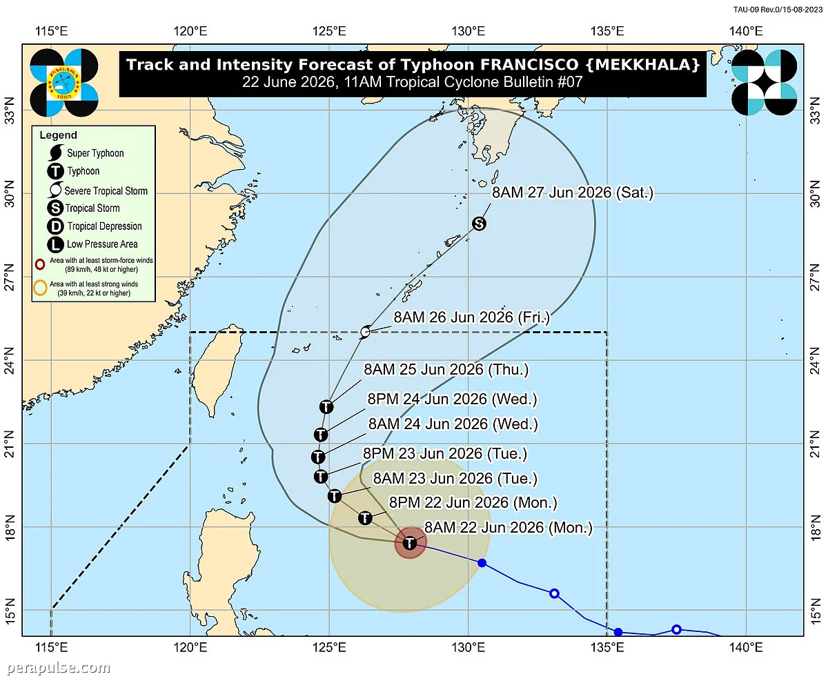
Typhoon Francisco has intensified as it moves west northwest over the Philippine Sea, prompting warnings from the Philippine Atmospheric, Geophysical and Astronomical Services Administration (Pagasa). As of June 22, 2026, it was located 620 kilometers east of Tuguegarao City, Cagayan.
Current Status and Warnings
The typhoon is packing maximum sustained winds of 155 kilometers per hour (kph) and gusts up to 190 kph. It is traveling at a speed of 15 kph.
Minimal to minor impacts from strong winds are possible in areas under the wind signal, with winds of 39 to 61 kph expected within 36 hours.
Pagasa Bulletin
Pagasa has advised mariners to avoid rough seas in the eastern waters of Babuyan Islands and mainland Cagayan, where waves could reach heights of 3.5 meters.
Forecast and Precautions
Francisco is expected to continue its northwestward path before turning toward the Ryukyu Islands in Japan. Though the typhoon is likely to remain far from the Philippine landmass, Pagasa cautioned that heavy rainfall and strong winds could still affect areas outside the forecast confidence cone.
Residents in affected regions are urged to stay updated on weather conditions, prepare their homes for potential damage, and take precautions against flooding.
As the typhoon may reach super typhoon status, vigilance is essential for those in potentially impacted areas.