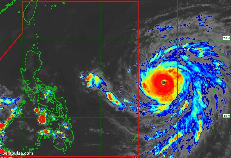
Super Typhoon Champi has regained its strength, clocking maximum sustained winds of 185 kilometers per hour (km/h) as it nears the
Anticipated Weather Impact
The storm is expected to enter PAR by October 20, where it will be assigned the local name Rosal. As of 4 PM on October 19, Champi was located approximately 1,515 kilometers east of southeastern Luzon and moving west northwest at 15 km/h.
Champi may trigger scattered rain and thunderstorms in Catanduanes, Northern Samar, and Eastern Samar even before its entry into PAR.
PAGASA Advisory
PAGASA warns that Champi's trough could bring significant rainfall and increase the risk of flash floods and landslides in affected areas. Wind signals could also be raised for parts of Northern Luzon and Bicol as early as Monday evening.
The super typhoon is likely to follow a path that keeps it over the Philippine Sea, potentially strengthening further before gradually weakening after October 21.
Coastal areas in northern and eastern Luzon, as well as parts of the Visayas and Mindanao, should prepare for rough seas starting Tuesday, with very rough conditions expected from Wednesday onward.
This year's typhoon season is notably affected by the ongoing El Niño phenomenon, which is predicted to intensify later this year, potentially impacting weather patterns across the Philippines.