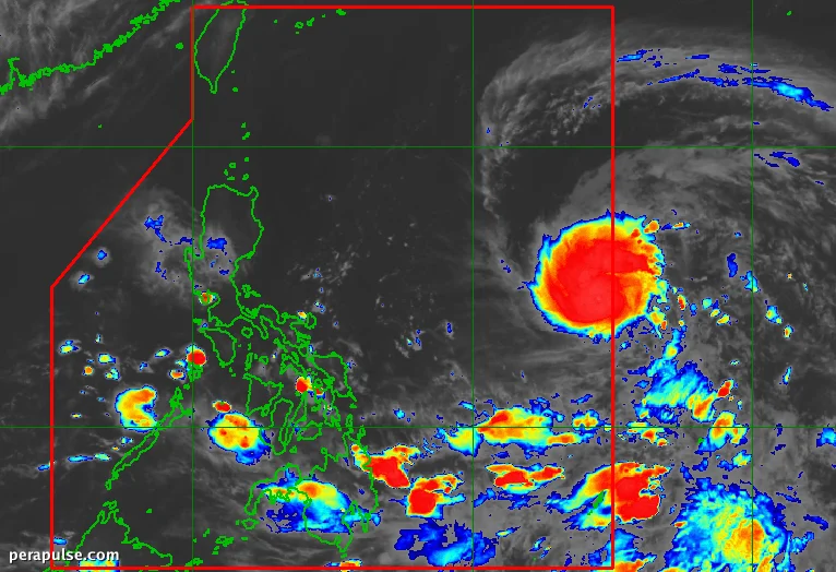
Severe Tropical Storm Francisco, known internationally as Mekkhala, has officially entered the Philippine Area of Responsibility (PAR) as of June 20, 2026.
The Philippine Atmospheric, Geophysical, and Astronomical Services Administration (PAGASA) reported that the storm, located 1,295 kilometers east of southeastern Luzon, is moving west at a speed of 25 kilometers per hour.
With sustained winds of 95 km/h and gusts reaching up to 115 km/h, Francisco is poised to strengthen into a typhoon by June 21, with peak intensity expected by June 22.
Possible Impact Areas
While the storm is expected to remain over the Philippine Sea, its trough is already causing scattered rain and thunderstorms across Eastern Visayas, Caraga, and the Davao Region.
PAGASA has indicated that Signal No. 1 may be raised in northern and eastern parts of Northern Luzon, as strong winds from Francisco could affect these areas.
PAGASA Bulletin
In the next 24 hours, PAGASA warns that the eastern seaboards of Dinagat Islands, Siargao-Bucas Grande Islands, and parts of Davao Oriental should prepare for moderate seas with waves up to 2 meters.
The southwest monsoon, which officially began on May 30, is expected to exacerbate weather conditions as the rainy season progresses.