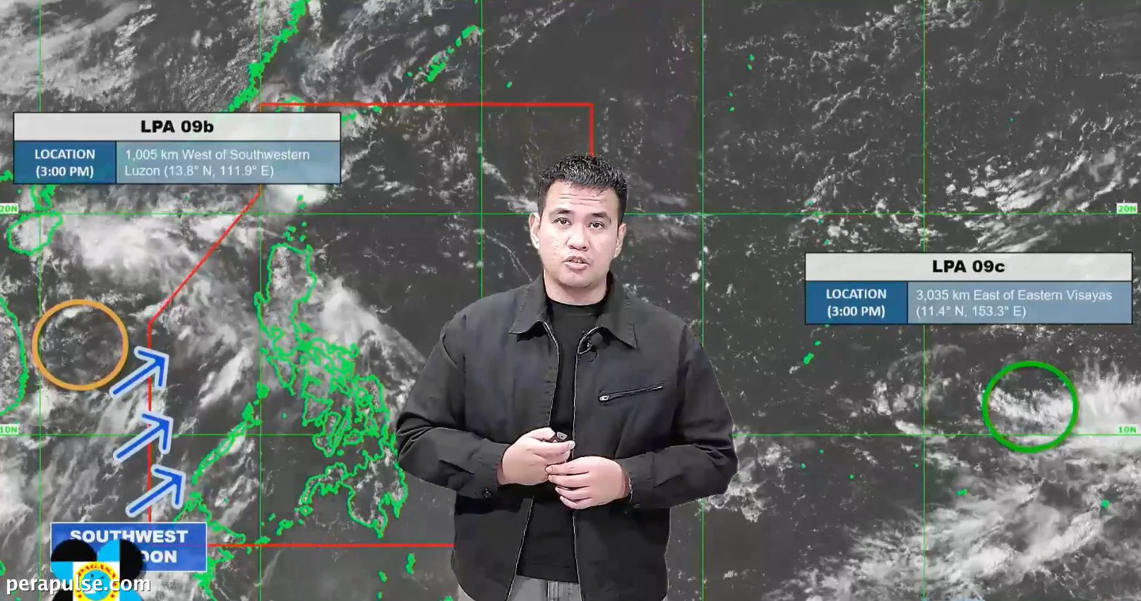
The Philippine Atmospheric, Geophysical, and Astronomical Services Administration (PAGASA) is currently monitoring two low pressure areas (LPAs) outside the Philippine Area of Responsibility (PAR) as of September 11, 2026.
The first LPA, emerging over the West Philippine Sea on September 10, is positioned approximately 1,005 kilometers west of southwestern Luzon. It carries a medium chance of developing into a tropical depression within the next 24 hours.
Despite its potential, PAGASA anticipates that this system will likely drift away from the Philippines, thus reducing the chances of it entering PAR.
Weather Implications Across the Country
The trough associated with this first LPA is currently causing scattered rain and thunderstorms in Northern Luzon, particularly affecting the Ilocos Region, Cordillera Administrative Region, and Cagayan Valley. Residents are advised to remain vigilant as the risk of flash floods and landslides exists.
In addition, scattered rains and thunderstorms are also impacting other areas of Luzon, Western Visayas, and Northern Samar, primarily due to the southwest monsoon, or *habagat*.
However, PAGASA indicates that the southwest monsoon is weakening, and significant rainfall is no longer anticipated.
The second LPA is located much further away, approximately 3,035 kilometers east of Eastern Visayas. Currently, it has a low likelihood of developing into a tropical depression within the next 24 hours and is not expected to impact the country shortly.
In September, PAGASA forecasts the potential formation of two to three tropical cyclones that could either develop or enter PAR. The next tropical cyclone names slated for this month are Queenie, Rosal, and Samuel.