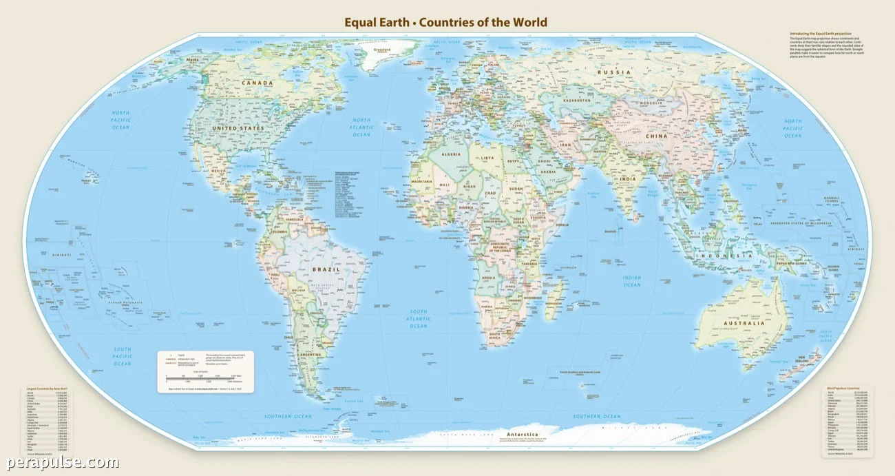
Inaprubahan ng Pangkalahatang Asembleya ng Nagkakaisang Bansa ang isang makabagong resolusyon na nag-aayos ng pandaigdigang kartograpiya sa pamamagitan ng pagpapalaki ng representasyon ng Africa habang pinapaliit ang mga sukat ng Hilagang Amerika at Europa. Ang desisyong ito, na ginawa noong Setyembre 4, 2026, ay nakatanggap ng matinding kritisismo mula sa Estados Unidos.
Isang Panawagan para sa Tumpak na Representasyon
Kaya't sila ay hindi kailanman neutral; kapag sila ay nagtatanghal ng isang baluktot na imahe ng ating planeta, sila ay nanganganib na ipagpatuloy ang hindi tumpak na representasyon na naipapasa sa mga henerasyon. (cite: Robert Dussey, Ministro ng Ugnayang Panlabas ng Togo)
- 164 na bansa ang sumuporta sa resolusyon.
- Ang US at anim na ibang bansa ay bumoto laban o nag-abstain.
- Ang bagong mapa ay batay sa Equal Earth cartographic projection.
Ang resolusyon ay sinusuportahan ng 164 na bansa, na nagpapakita ng lumalaking pagkilala sa pangangailangan para sa mas pantay na paglalarawan ng pandaigdigang heograpiya. Tinutulan ng US ang resolusyon, kung saan ang kanilang kinatawan ay nag-argumento na dapat tumutok ang UN sa mga mahahalagang pandaigdigang isyu sa halip na sa mga debate sa kartograpiya.
Ang Equal Earth cartographic projection, na binuo noong 2018, ay nagsusumikap na magbigay ng mas tumpak na representasyon ng mga sukat ng lupa, itinutuwid ang mga baluktot na presentasyon sa tradisyunal na Mercator projection. Ang mas lumang metodong ito, na nilikha noong 1569, ay madalas na nagpapalaki ng sukat ng mga masa ng lupa sa hilagang hemisphere, na nagreresulta sa isang baluktot na pananaw ng pandaigdigang heograpiya.
Binigyang-diin ni French Foreign Minister Jean-Noel Barrot, isang co-sponsor ng resolusyon, ang kahalagahan ng pagtutuwid sa mga makasaysayang pagkakamali, na nagsasabing ang pagbabago ng mga mapa ay isang hakbang patungo sa katotohanan.
Ang inisyatibong ito ay umaayon sa mga pagsisikap ng Pransya na palakasin ang ugnayan sa mga bansang Aprikano, partikular sa mga bansang may kumplikadong relasyon, habang ito ay nagsusumikap na itaguyod ang mas mabuting ugnayang diplomatiko.