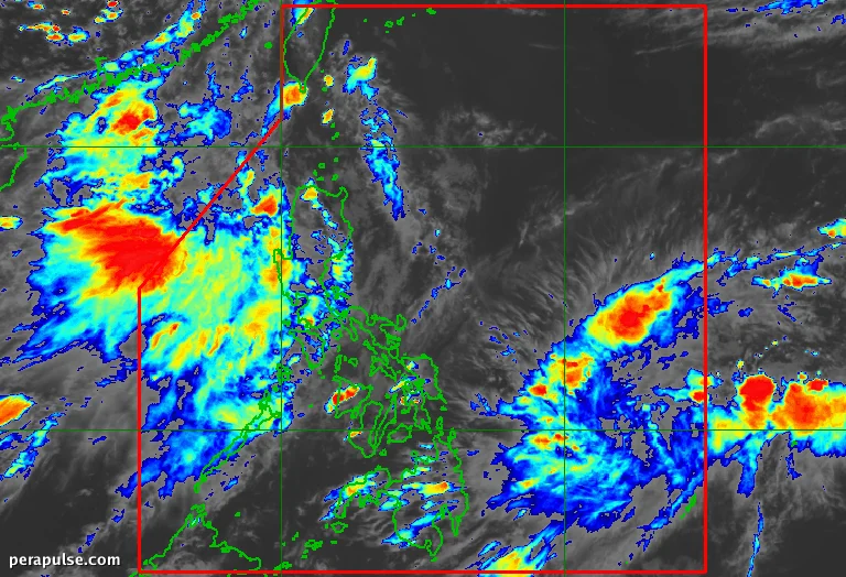
Isang low pressure area (LPA) na matatagpuan sa labas ng Philippine Area of Responsibility (PAR) ay lumakas at naging tropical depression noong Hulyo 13, 2026. Iniulat ng Philippine Atmospheric, Geophysical, and Astronomical Services Administration (PAGASA) na ang sistemang ito ay kasalukuyang mga 1,205 kilometro silangan ng Eastern Visayas.
Kasalukuyang Katayuan at Paggalaw
Noong 3 PM, ang tropical depression ay gumagalaw sa hilagang-kanluran sa bilis na 10 kilometro bawat oras, na may maximum sustained winds na 55 km/h at mga bugso na umaabot sa 70 km/h. Inaasahan ng PAGASA na ang sistema ay maaaring pumasok sa PAR sa huli ng Hulyo 13 o maagang Hulyo 14, kung saan ito ay papangalanang Josie.
Malamang na mananatili ito malapit sa silangang hangganan ng PAR, at posibleng lumabas sa Hulyo 15.
(cite: PAGASA)
Bagamat may posibilidad na ang sistema ay lumakas at maging tropical storm, binibigyang-diin ng mga meteorologist na ang landas nito ay nagpapahiwatig ng kaunting epekto sa Pilipinas. Inaasahang ang sistema ay gagalaw patungong hilaga bago lumipat sa hilagang-silangan na direksyon.
Mga Epekto ng Southwest Monsoon
Sa kabila ng limitadong banta ng tropical depression na ito, ang southwest monsoon, o *habagat*, ay patuloy na nakakaapekto sa mga pattern ng panahon sa buong Luzon. Ang mga rehiyon tulad ng Ilocos, Benguet, Zambales, Bataan, at Tarlac ay nakakaranas ng mga kalat-kalat na pag-ulan at thunderstorms.
Habang ang bansa ay naghahanda para sa mga kasalukuyang sistema ng panahon, pinapayuhan ang mga residente na manatiling updated sa mga forecast at maging handa para sa biglaang pagbabago sa kondisyon ng panahon.