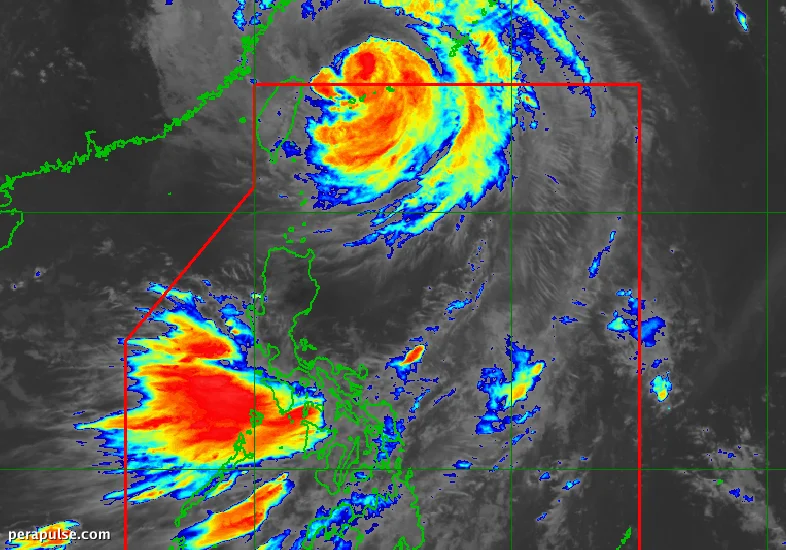
Typhoon Inday, also known as Bavi, officially left the Philippine Area of Responsibility (PAR) on July 11, 2026, at 8:20 AM. However, its outer bands continue to enhance the southwest monsoon, affecting weather patterns across the country.
Ongoing Weather Warnings
As of 10 AM on the same day, Inday was positioned approximately 590 kilometers north-northeast of Itbayat, Batanes, moving north-northwest at a speed of 20 kilometers per hour. The typhoon's maximum sustained winds were recorded at 140 km/h, with gusts reaching up to 170 km/h.
Inday was classified as a super typhoon at its peak, with maximum sustained winds of 195 km/h within PAR.
PAGASA Bulletin
Despite Inday's exit, parts of Luzon and the Visayas should remain vigilant due to the southwest monsoon's influence. PAGASA has issued warnings for potential flooding and landslides as the rain persists.
Coastal Warnings Issued
Travelers should exercise caution, particularly in areas experiencing high waves. Coastal warnings remain in effect for various regions, including Batanes, where waves could reach up to 7 meters.
The typhoon was the Philippines' ninth tropical cyclone of the year and the second for July. Experts predict the formation of two to four additional tropical cyclones within or entering PAR during the month.