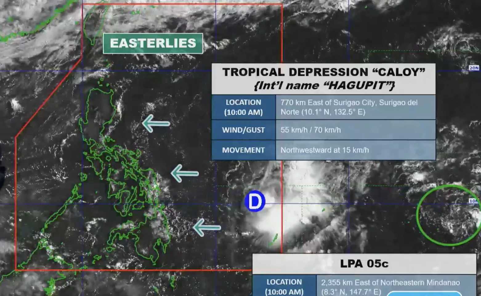
Tropical Depression Caloy (Hagupit) has downgraded from a tropical storm as it continues its trajectory over the Philippine Sea. The Philippine Atmospheric, Geophysical, and Astronomical Services Administration (PAGASA) reported this development on Sunday morning.
Caloy's maximum sustained winds have decreased from 65 kilometers per hour to 55 km/h, while its gustiness has also dropped to 70 km/h. As of 10 AM, it was located 770 kilometers east of Surigao City, moving northwest at a slow pace of 10 km/h.
Currently, Caloy is not directly impacting any part of the Philippines. However, PAGASA's Weather Specialist Grace Castañeda indicated that the depression's trough could bring scattered rain showers to Eastern Visayas and Caraga starting Sunday night.
In the meantime, the weather across the country remains generally fair, with only isolated rain showers due to easterly winds from the Pacific Ocean.
Expected Conditions and Precautions
As Caloy weakens further into a remnant low by Monday, May 11, PAGASA has advised caution for small vessels, particularly in the eastern seaboards where waves could reach up to 2.5 meters.
The tropical depression entered the Philippine Area of Responsibility on May 9, marking the country's third tropical cyclone of the year and the first in May.
PAGASA continues to monitor a low pressure area (LPA) located outside PAR, which is currently not expected to develop into a tropical cyclone within the next 24 hours.
PAGASA