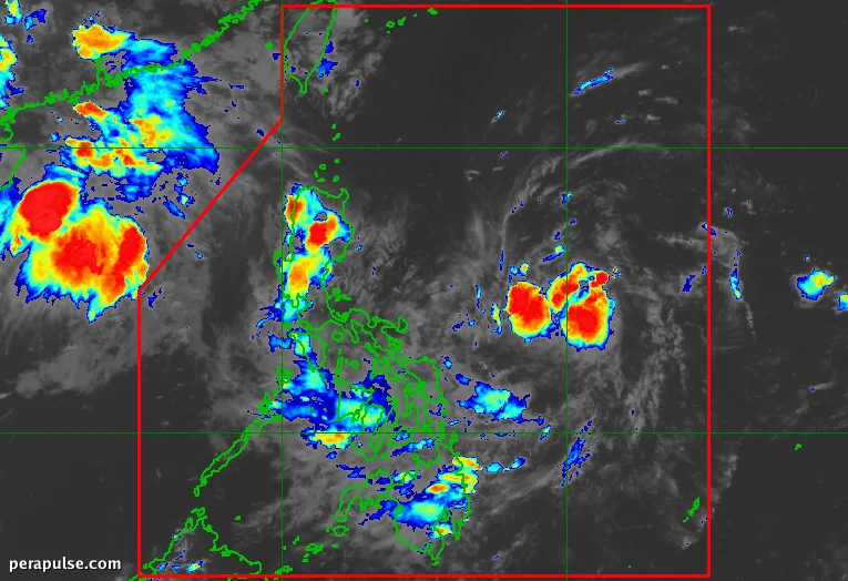
Ang pag-ulan ay nakaapekto sa Visayas, Mindanao, at mga bahagi ng Timog Luzon dahil sa trough ng isang low-pressure area (LPA) na kasalukuyang matatagpuan 865 kilometro silangan ng timog-silangang Luzon.
Naglabas ng Babala sa Panahon ang PAGASA
Kumpirmado ng Philippine Atmospheric, Geophysical, and Astronomical Services Administration (PAGASA) na ang LPA ay pumasok sa Philippine Area of Responsibility noong Hulyo 31, 2026, ngunit may mababang posibilidad na umakyat ito sa isang tropical depression.
Ang mga residente sa mga apektadong lugar ay dapat manatiling mapagbantay para sa posibleng flash floods at landslides.
(source: tagapagsalita ng PAGASA)
Habang nararamdaman ang epekto ng LPA, ang natitirang bahagi ng Luzon ay nakakaranas ng medyo tahimik na panahon. Gayunpaman, nagbabala ang PAGASA na ang southwest monsoon, na kilala sa lokal bilang 'habagat', ay inaasahang babalik sa susunod na linggo.
Ang potensyal na pagbabalik na ito ay konektado sa Tropical Cyclone Dolphin, na kasalukuyang isang super typhoon na nasa humigit-kumulang 4,000 kilometro ang layo, na maaaring magpalakas ng mga kondisyon ng monsoon at magdulot ng makabuluhang ulan.
Historically, ang Pilipinas ay nakakaranas ng sunud-sunod na tropical cyclones sa panahon ng tag-ulan, at noong Hulyo lamang ay nakakita ng apat na sistema, kabilang ang Typhoon Kiyapo.
Tumingin sa hinaharap, tinatayang ng PAGASA na dalawa hanggang apat na tropical cyclones ang maaaring bumuo o pumasok sa Philippine Area of Responsibility sa Agosto.