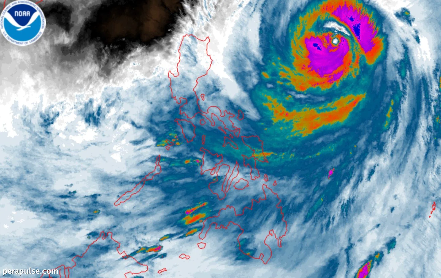
Nabawasan ang Bagyong Inday, na dati nang nakategorya bilang isang super typhoon, at ngayo'y itinuturing na bagyo habang ito ay gumagalaw sa karagatang Pilipino. Noong Hulyo 9, 2026, ito ay matatagpuan sa humigit-kumulang 925 kilometro silangan ng
Hilagang Luzon
at may dalang pinakamataas na tuloy-tuloy na hangin na 175 kilometro bawat oras.
Taya ng Panahon at Epekto
Iniulat ng Philippine Atmospheric, Geophysical, and Astronomical Services Administration (PAGASA) na inaasahang magiging pinakamalapit si Inday sa
Hilagang Luzon
sa Biyernes ng gabi o Sabado ng umaga. Dapat maghanda ang mga residente para sa mga kondisyon na maaaring magdulot ng pagbaha at pagguho ng lupa.
Si Inday ang ikasiyam na tropical cyclone ng Pilipinas para sa 2026, at ang pangalawa para sa Hulyo.
PAGASA
Palalakasin din ng impluwensya ni Inday ang southwest monsoon, na magdudulot ng mga kalat-kalat na ulan at thunderstorms sa buong
Mimaropa
, Western Visayas, at mga bahagi ng Mindanao.
Mga Babala at Pag-iingat
Noong 5 AM Huwebes, itinaas ang Signal No. 1 sa ilang rehiyon, kabilang ang Batanes at mga bahagi ng Cagayan. Dapat maging mapagmatyag ang mga residente sa mga lugar na ito dahil ang hangin ay maaaring umabot sa lakas ng bagyo.
Lumala ang kondisyon ng dagat, na nagdudulot ng panganib para sa paglalakbay sa dagat. Nagbabala ang PAGASA ng napakalalakas na alon, lalo na sa hilagang-silangang baybayin.
Inaasahang lalabas si Inday sa Philippine Area of Responsibility (PAR) sa Sabado at maaaring tumama sa lupa sa Tsina sa Linggo, na posibleng magdulot ng karagdagang paghina.