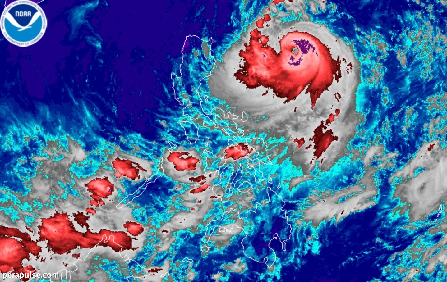
Typhoon Francisco (Mekkhala) has intensified significantly as it moves through the Philippine Sea, currently situated 620 kilometers east of Tuguegarao City, Cagayan. As of June 22, 2026, its maximum sustained winds have increased from 140 km/h to 155 km/h.
Increased Strength and Forecast
The Philippine Atmospheric, Geophysical, and Astronomical Services Administration (PAGASA) reported that Francisco's gustiness has also risen to 190 km/h. The agency has not ruled out the possibility of the storm reaching super typhoon status, defined by sustained winds of at least 185 km/h.
PAGASA is monitoring the storm closely and advises that while Francisco is not expected to make landfall, a slight shift towards the west could bring significant rainfall to vulnerable areas.
PAGASA Bulletin
While the typhoon is anticipated to curve away from the Philippines towards Japan’s Ryukyu Islands, its outer bands are already affecting large parts of Luzon and the Visayas. The southwest monsoon is also contributing to scattered rainfall across the region.
Current Weather Warnings
Certain areas remain under Signal No. 1, indicating strong winds are expected. These areas include:
Francisco marks the sixth tropical cyclone of 2026 for the Philippines and the second for June. It is expected to exit the Philippine Area of Responsibility by June 26.