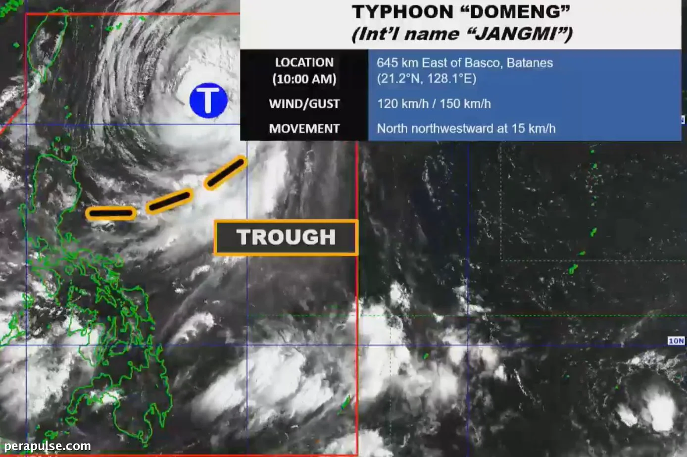
Bagyong Domeng (Jangmi) patuloy na nagpapakita ng lakas sa Dagat ng Pilipinas, nagdudulot ng makabuluhang banta sa panahon habang ito ay tumutungo patungong hilagang-kanluran sa bilis na 15 km/h. Noong Mayo 31, 2026, ito ay naitala na 645 kilometro silangan ng Basco, Batanes.
Epekto ng Panahon sa Buong Pilipinas
Ayon sa Philippine Atmospheric, Geophysical and Astronomical Services Administration (PAGASA), Domeng ay may pinakamataas na patuloy na hangin na 120 kilometro bawat oras, na may mga bugso na umaabot sa 150 km/h. Sa kabila ng kanyang landas, hindi inaasahang tatama ang bagyo sa lupa ng Pilipinas.
Ang trough ng Bagyong Domeng ay nagdulot ng mga nakakalat na ulan at mga bagyo sa Central Luzon, Cagayan, at Isabela, na nagdudulot ng mga alalahanin tungkol sa biglaang pagbaha at pagguho ng lupa.
(cite: PAGASA)
Habang umuusad ang sitwasyon, nagbabala ang PAGASA na ang mga lugar sa paligid ni Domeng ay makakaranas ng malakas hanggang sa mga bugso ng hangin. Pinapayuhan ang mga komunidad sa baybayin na mag-ingat dahil sa magaspang na kondisyon ng dagat.
Bagaman hindi inaasahang itataas ang mga signal ng hangin ng tropical cyclone, mararamdaman ang epekto ng mga panlabas na banda ni Domeng sa iba't ibang rehiyon, kabilang ang Visayas at mga bahagi ng Mindanao.
Bagyong Domeng ay ang ikaapat na tropical cyclone na nakaapekto sa Pilipinas ngayong taon at ang pangalawa sa Mayo. Pinapayuhan ang publiko na manatiling alerto, lalo na't inaasahang magsisimula na ang panahon ng ulan.