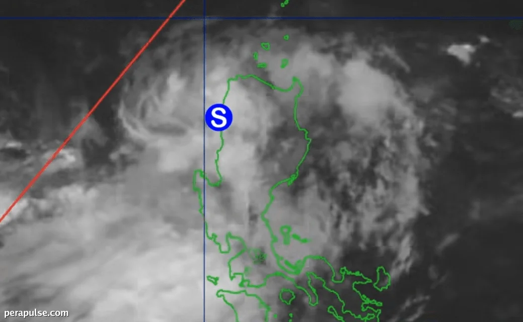
Tumama ang Tropical Storm Maymay (Kujira) sa lupa sa Magsingal, Ilocos Sur ng 2 AM noong Agosto 6, 2026, ayon sa Philippine Atmospheric, Geophysical and Astronomical Services Administration (PAGASA).
Kasalukuyang Katayuan at Epekto
Sa maximum sustained winds na 75 km/h at gustiness na umaabot sa 105 km/h, kasalukuyang kumikilos si Maymay patungong silangan sa mabagal na bilis na 10 km/h. Malakas na ulan ang naiulat sa buong Hilaga at Gitnang Luzon.
Inaasahang humina ang bagyo sa isang tropical depression mamayang hapon habang ito ay tumatawid sa mga bundok.
(cite: PAGASA)
Ang forecast ay nagpapakita ng patuloy na pag-ulan para sa iba't ibang lalawigan, kabilang ang katamtaman hanggang sa malakas na ulan para sa Ilocos Sur, La Union, Pangasinan, at Benguet.
Mga Panganib ng Baha at Landslide
Habang nakikipag-ugnayan si Maymay sa southwest monsoon, tumataas ang mga panganib ng pagbaha at landslide sa mga apektadong lugar. Nagbigay babala ang PAGASA na ang mga kondisyon ay maaaring magdulot ng malubhang mga kaganapan sa panahon.
Babala ng Tropical Cyclone
Itinaas ang mga signal ng hangin sa ilang lalawigan: Signal No. 2 ay nasa bisa para sa Ilocos Norte at mga bahagi ng La Union, habang ang Signal No. 1 ay nakakaapekto sa ibang mga lugar sa rehiyon.
Kahit na ang mga lokasyon na hindi sakop ng signal ng hangin ay maaaring makaranas pa rin ng malalakas na hangin habang ang mga panlabas na bahagi ni Maymay ay nakakaimpluwensya sa mga pattern ng panahon sa buong bansa.
Mga Hinaharap na Kaganapan
Si Maymay ang ika-13 tropical cyclone sa Pilipinas para sa 2026 at ang pangalawa sa Agosto. Isang potensyal na cyclone, ang Typhoon Dolphin, ay kasalukuyang nasa silangang baybayin at maaaring makaapekto rin sa southwest monsoon.