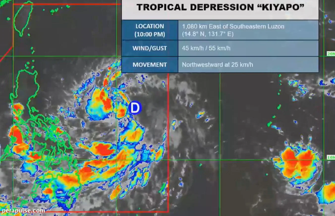
Nakumpirma ng Philippine Atmospheric, Geophysical and Astronomical Services Administration (PAGASA) na ang isang low pressure area ay umunlad sa Kiyapo, na siyang ika-11 na tropical cyclone ng Pilipinas ngayong taon at ang ika-apat sa Hulyo, na nagdadala ng malaking panganib habang papalapit ito sa rehiyon ng Cagayan.
Inaasahang Daan at Epekto
Maaaring tumama si Kiyapo sa mga pulo ng Babuyan sa lalawigan ng Cagayan sa Biyernes ng gabi, Hulyo 24, na may potensyal na lumakas bilang isang tropical storm.
(cite: PAGASA)
Habang papalapit si Kiyapo sa lugar ng Cagayan, naglabas ang PAGASA ng Signal No. 1 para sa mga bahagi ng Cagayan at Isabela, na nagpapaalala sa mga residente na maghanda para sa malalakas na hangin.
Dapat maging mapagbantay ang mga residente sa silangang bahagi ng Cagayan at Isabela dahil maaaring magdala ang bagyo ng malakas na pag-ulan at mataas na hangin.
Pag-ulan at Karagdagang Babala
Ang inaasahang pag-ulan mula kay Kiyapo ay makabuluhan, na may mga forecast na nagpapakita ng mabigat hanggang matinding pag-ulan sa mga sumusunod na lugar: Nagbabala rin ang PAGASA na ang southwest monsoon ay mag-aambag sa masamang kondisyon ng panahon, na makakaapekto sa karamihan ng bansa.
Nagbabala ang mga awtoridad ng posibleng pagbaha at pagguho ng lupa sa mga bulnerableng lugar.
Mga Pag-iingat sa Kaligtasan
Pinapayuhan ang mga maliliit na sasakyang-dagat na iwasan ang paglalayag dahil sa magaspang na dagat, partikular sa timog-silangang at silangang baybayin ng Davao.
Matapos tumama sa lupa, inaasahang lalabas si Kiyapo sa Philippine Area of Responsibility (PAR) sa Hulyo 25.