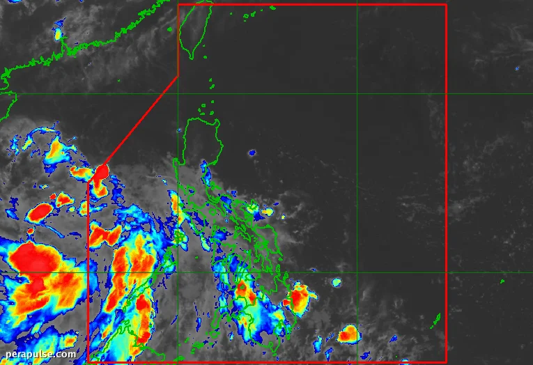
Umalis ang Tropical Depression Henry sa Philippine Area of Responsibility (PAR) noong Hulyo 1, 2026, labing-walo na oras matapos itong mabuo. Sa ganap na 10 PM, ito ay matatagpuan 470 kilometro kanluran ng Bacnotan, La Union.
Mabilis na Pag-unlad at Pag-alis
PAGASA reported that Henry developed at 2 AM on July 1 and quickly gained strength, reaching maximum sustained winds of 45 km/h at gustiness of up to 55 km/h.
Sa kabila ng mabilis na pag-alis nito, patuloy na naaapektuhan ng mga panlabas na banda ni Henry ang iba't ibang rehiyon, na nagdudulot ng mga kalat-kalat na ulan at thunderstorms. (cite: PAGASA)
Kahit na umalis na si Henry sa PAR, nananatili ang impluwensya nito. Kumpirmado ng PAGASA na inaasahang magkakaroon ng kalat-kalat na ulan at thunderstorms sa Zambales and Bataan dahil sa tropical depression.
Mga Paparating na Pattern ng Panahon
Ang southwest monsoon, o *habagat*, ay nag-aambag din sa mga kaguluhan sa panahon sa buong rehiyon. Inaasahan ng PAGASA ang katulad na mga kondisyon sa iba pang mga lugar kabilang ang Occidental Mindoro at Zamboanga Peninsula.
Ang kondisyon ng dagat ay malamang na katamtaman na may mga alon na umaabot ng hanggang 2.5 metro sa ilang bahagi ng Luzon. Pinapayuhan ang mga maliliit na sasakyang-dagat na mag-ingat.
Pagtataya sa mga Hinaharap na Cyclone
Si Henry ay nagmamarka ng ikawalong tropical cyclone ng Pilipinas para sa taon, at ang una para sa Hulyo. Inaasahan ng PAGASA ang 9 hanggang 13 karagdagang cyclone na papasok sa PAR mula Hulyo hanggang Disyembre 2026.