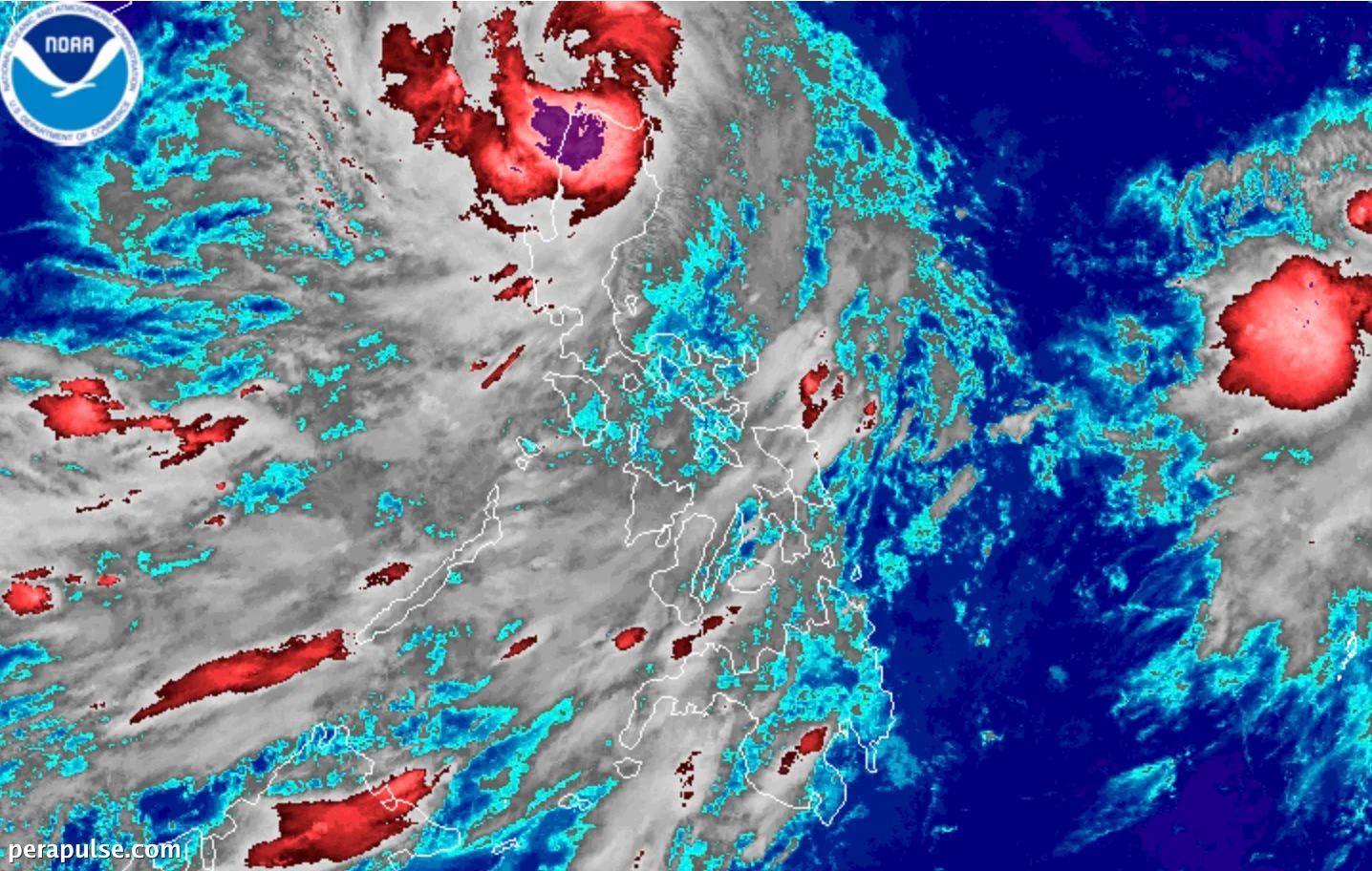
Ang Malubhang Bagyong Tropikal Kiyapo (Noul) ay umigting habang ito ay papalapit sa mga Pulo ng Babuyan, na nag-udyok sa mga awtoridad na itaas ang Signal No. 3 para sa tatlong mga pulo sa grupo. Noong Hulyo 24, 2026, ang pinakamataas na tulin ng hangin ni Kiyapo ay umabot sa 95 kilometro bawat oras.
Kasalukuyang Katayuan at Daan ng Bagyo
Ayon sa Philippine Atmospheric, Geophysical, and Astronomical Services Administration (PAGASA), si Kiyapo ay kasalukuyang nasa mga baybaying tubig ng
Ayon sa Philippine Atmospheric, Geophysical, and Astronomical Services Administration (PAGASA), si Kiyapo ay kasalukuyang nasa mga baybaying tubig ng Pulo ng Calayan, na gumagalaw patungong kanluran-hilagang-kanluran sa bilis na 25 kilometro bawat oras.
Si Kiyapo ang ika-11 na tropikal na siklon para sa Pilipinas sa 2026 at ang ika-apat lamang sa Hulyo. (cite: PAGASA)
Mga Lugar na Sakop ng mga Signal ng Hangin ng Tropikal na Siklon
Iniulat din ng PAGASA na ang mga panlabas na bandang ng bagyo ay nag-aambag sa malakas hanggang sa malupit na hangin sa maraming rehiyon, na nagpapalala sa mga kondisyon ng panahon na kaugnay ng timog-kanlurang monsoon.
Panganib ng Ulan at Baha
Inaasahan ang malakas na pag-ulan sa Hilagang Luzon, kung saan hinuhulaan ng PAGASA ang 100-200 milimetro sa mga lugar tulad ng Cagayan at Apayao sa loob ng susunod na 24 na oras.
Habang umuusad ang bagyo, tumaas ang mga alalahanin tungkol sa pagbaha at pagguho ng lupa, partikular sa mga mahihinang lugar.
Mga Kondisyon sa Paglalakbay at Dagat
Ang mga kondisyon sa paglalakbay sa dagat ay inaasahang mapanganib din, kung saan nagbabala ang PAGASA ng
Ang mga kondisyon sa paglalakbay sa dagat ay inaasahang mapanganib din, kung saan nagbabala ang PAGASA ng katamtaman hanggang sa napakalupit na dagat sa ilang mga baybaying lugar.
Habang umuusad si Kiyapo palabas ng Philippine Area of Responsibility, maaari itong lumakas, na posibleng maging bagyong tayfun bago tumama sa lupa sa mainland China.