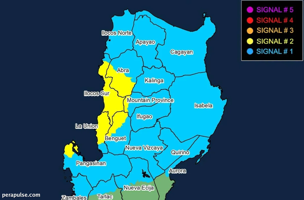
Itinaas ng Philippine Atmospheric, Geophysical and Astronomical Services Administration (Pagasa) ang Signal No. 2 sa anim na rehiyon ng Luzon habang
Mga Apektadong Lugar sa ilalim ng Signal No. 2
Nag-ulat ang Pagasa na si Maymay ay may maximum sustained winds na 65 kilometers per hour, na may mga bugso na umaabot sa 80 kph, at dahan-dahan itong kumikilos patimog-silangan. Inaasahang tatama ang bagyo sa Ilocos Sur o La Union sa Miyerkules ng hapon o gabi.
Ang mga lugar sa ilalim ng Signal No. 1 ay kinabibilangan ng Ilocos Norte, ang natitirang bahagi ng Ilocos Sur, La Union, Pangasinan, at iba pang lugar sa hilagang Luzon.
(sipi: Pahayag ng Opisyal ng Pagasa)
Matapos ang pagtama nito, inaasahang hihina si Maymay at magiging isang tropical depression sa Huwebes ng umaga, na may posibilidad ng karagdagang pagbaba sa antas sa mas huling bahagi ng araw.
Inaasahang Kondisyon ng Panahon
Ang nalalapit na bagyo ay nagdudulot ng mga kritikal na alalahanin tungkol sa posibleng biglaang pagbaha at pagguho ng lupa. Binibigyang-diin ng Pagasa ang panganib ng katamtaman hanggang malalakas na pag-ulan sa mga apektadong lugar, na pinapayuhan ang mga residente na maging mapagmatyag.
Habang papalapit si Maymay, ang mga nasa Gitnang Luzon ay maaaring asahan ang maulap na kalangitan na may mga nakakalat na pag-ulan, habang ang natitirang bahagi ng bansa ay makakaranas ng bahagyang maulap na kondisyon na may mga nakahiwalay na ulan.