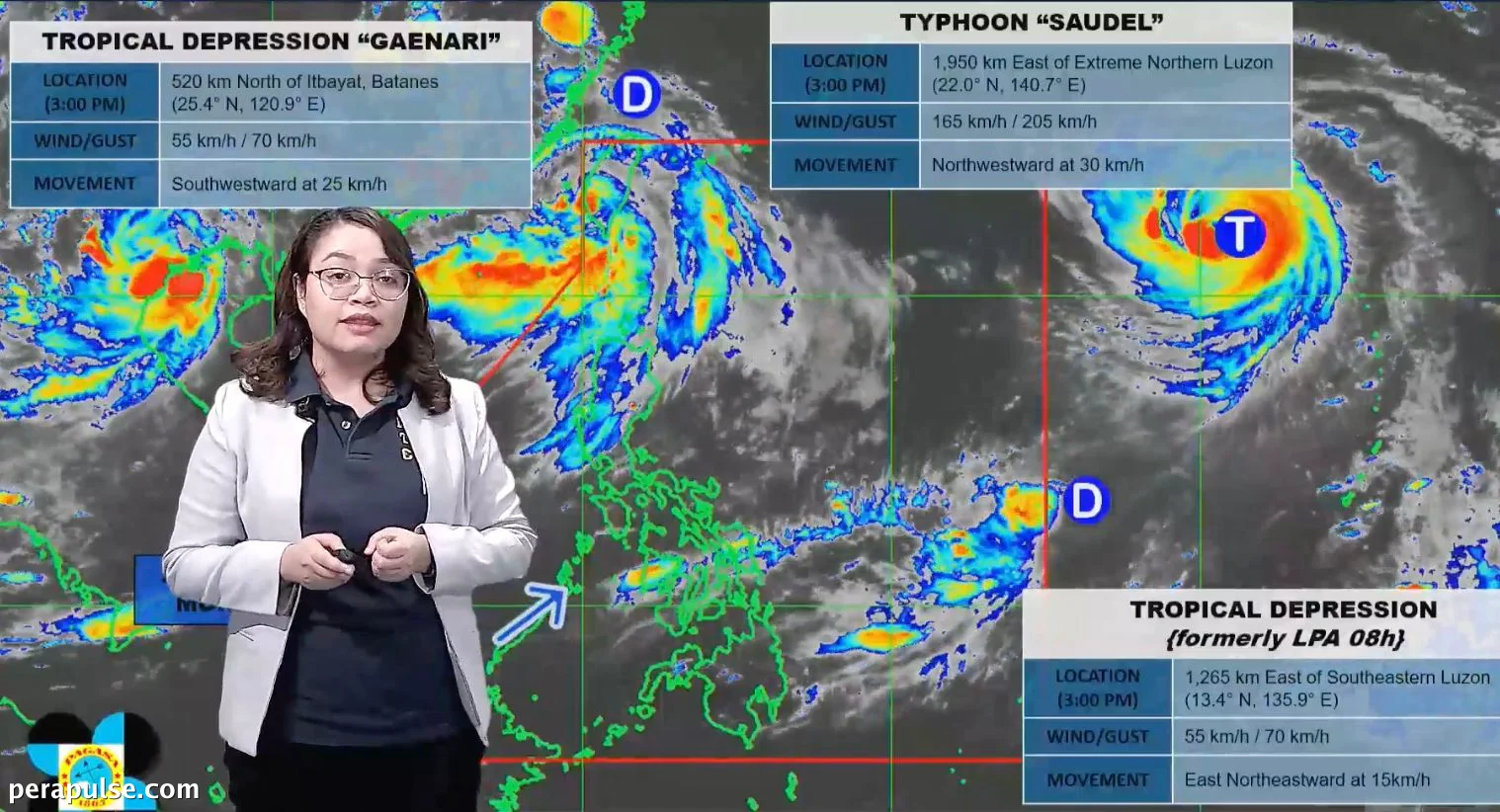
Inaasahang papasok si Typhoon Saudel sa Philippine Area of Responsibility (PAR) sa Agosto 24, marahil bilang isang super typhoon. Noong Agosto 23, ito ay matatagpuan sa 1,950 kilometro silangan ng pinakahilagang Luzon.
Epekto ni Saudel sa mga Pattern ng Panahon
May maximum sustained winds na 165 km/h at mga bugso na umaabot sa 205 km/h, si Saudel ay inaasahang magpapatindi sa timog-kanlurang monsoon, na medyo mahina simula noong Agosto 20.
Ang inaasahang pagpapalakas ng timog-kanlurang monsoon ay maaaring magdulot ng makabuluhang pag-ulan simula Miyerkules, Agosto 26.
(cite: Charmagne Varilla, PAGASA Weather Specialist)
Ang potensyal na si Saudel ay manatili sa PAR o mabilis na lumabas ay nakasalalay sa kanyang landas. Kung ito ay kumilos patungong kanluran, maaari itong makaapekto sa mga pattern ng panahon nang mas matagal kaysa sa inaasahan.
Ang lokal na pangalan ng bagyo ay nakasalalay sa trajectory ng isa pang tropical depression na kasalukuyang matatagpuan sa 1,265 kilometro silangan ng timog-silangang Luzon. Ang depression na ito, na maaaring pumasok sa PAR bago si Saudel, ay umaalis mula sa lugar.
Nagbabala ang Philippine Atmospheric, Geophysical and Astronomical Services Administration (PAGASA) sa mga residente sa hilagang Luzon na maghanda para sa katamtaman hanggang sa malakas na pag-ulan.
Historically, ang Agosto ay madalas na nakakaranas ng maraming tropical cyclones na nakakaapekto sa Pilipinas. Sa taong ito, hinulaan ng PAGASA ang pagkakaroon ng apat, kung saan tatlo na ang naitala: Tropical Depression Luis, Tropical Storm Maymay, at ang kamakailang Neneng.