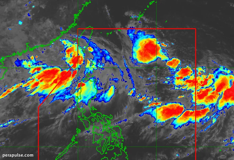
As of August 31, 2026, Tropical Depression Pilandok ay patuloy na pinananatili ang lakas nito habang nag-aambag sa makabuluhang ulan ng habagat sa mga bahagi ng hilagang Luzon. Ang Philippine Atmospheric, Geophysical, and Astronomical Services Administration (PAGASA) ay nag-ulat na si Pilandok ay kasalukuyang matatagpuan 1,145 kilometro silangan ng matinding Hilagang Luzon.
Mga Bagyo at Epekto ng Habagat
Si Pilandok ay inaasahang magiging bagyong tropikal sa Setyembre 1, na kumikilos patungong hilagang-kanluran sa bilis na 10 kilometro bawat oras. Kasama ni Pilandok, mayroong dalawang iba pang tropical depressions sa labas ng Philippine Area of Responsibility (PAR) na nagpapalakas sa southwest monsoon, na nagdudulot ng malakas na pag-ulan sa Rehiyon ng Ilocos, Abra, at Benguet.
Ang pinahusay na southwest monsoon ay nagdudulot ng malalakas na hangin at magaspang na dagat sa maraming lugar, na may mga babala para sa flash floods at pagguho ng lupa.
(cite: PAGASA Weather Specialist Charmagne Varilla)
Ang southwest monsoon, o 'habagat', ay nakakaapekto rin sa iba pang bahagi ng Luzon at sa kanlurang bahagi ng Visayas. Nagbigay ng babala ang PAGASA sa mga residente sa mga lugar na ito na maghanda para sa potensyal na flash floods at pagguho ng lupa.
Ang ahensya ay masusing nagmamasid sa tropical depression Saudel, na matatagpuan 1,075 km kanluran ng matinding Hilagang Luzon, na maaaring muling pumasok sa PAR. Si Saudel ay may mga hangin na 45 km/h at maaaring lumakas.
Dahil si Pilandok ay nananatiling malayo sa lupa, hindi ito inaasahang tatama sa lupa, ngunit ang impluwensya nito sa habagat ay magpapatuloy, na nakakaapekto sa mga pattern ng panahon sa buong rehiyon.
Pinapayuhan ang mga residente na manatiling updated sa mga alerto ng panahon habang umuusad ang sitwasyon. Patuloy na magbibigay ng mga update ang PAGASA tungkol kay Pilandok at sa kasalukuyang kondisyon ng habagat.