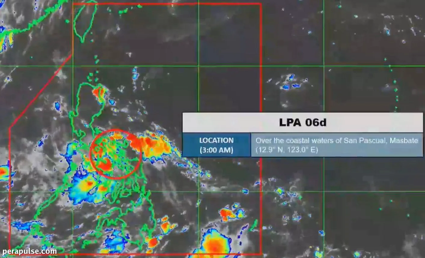
Isang low pressure area (LPA) ang kasalukuyang nakakaapekto sa Visayas at karamihan sa Timog Luzon habang papalapit ito sa lupain ng Pilipinas. Noong 3 AM ng Hunyo 30, 2026, ang LPA ay nasa ibabaw ng mga baybaying tubig ng San Pascual, Masbate.
Potensyal na Pag-unlad sa Tropical Depression
Ipinakita ng Philippine Atmospheric, Geophysical, and Astronomical Services Administration (PAGASA) na may mataas na posibilidad na lumakas ang LPA at maging tropical depression sa loob ng susunod na 24 na oras. Kung mangyari ito, ito ay papangalanang Henry.
Agad na itataas ang mga signal ng hangin ng tropical cyclone dahil sa kalapitan ng kaguluhan sa lupa.
PAGASA
Bilang paghahanda sa mga epekto ng LPA, inaasahan ng PAGASA ang mga nakakalat na ulan at thunderstorms sa iba't ibang rehiyon, kabilang ang:
- Visayas
- Metro Manila
- Calabarzon
- Bicol
- Occidental Mindoro
- Oriental Mindoro
- Marinduque
- Romblon
Nagbabala rin ang ahensya ng flash floods at landslides sa mga lugar na ito, partikular sa mga rehiyon na nakakaranas ng katamtaman hanggang sa malakas na pag-ulan.
Mga Proyeksiyon ng Ulan
Itinatampok ng tatlong araw na outlook ng PAGASA ang mga probinsyang maaaring maapektuhan nang malaki ng sistemang pangkalikasan na ito:
- Hunyo 30: Occidental Mindoro, Oriental Mindoro, Marinduque, Romblon, Aklan, Capiz (50-100 mm)
- Hulyo 1: Palawan, Occidental Mindoro (50-100 mm)
- Hulyo 2: Palawan (50-100 mm)
Ang LPA na ito ay sumusunod sa isang trend ng pagtaas ng pag-ulan habang opisyal na idineklara ng PAGASA ang pagsisimula ng tag-ulan noong Hunyo 4.