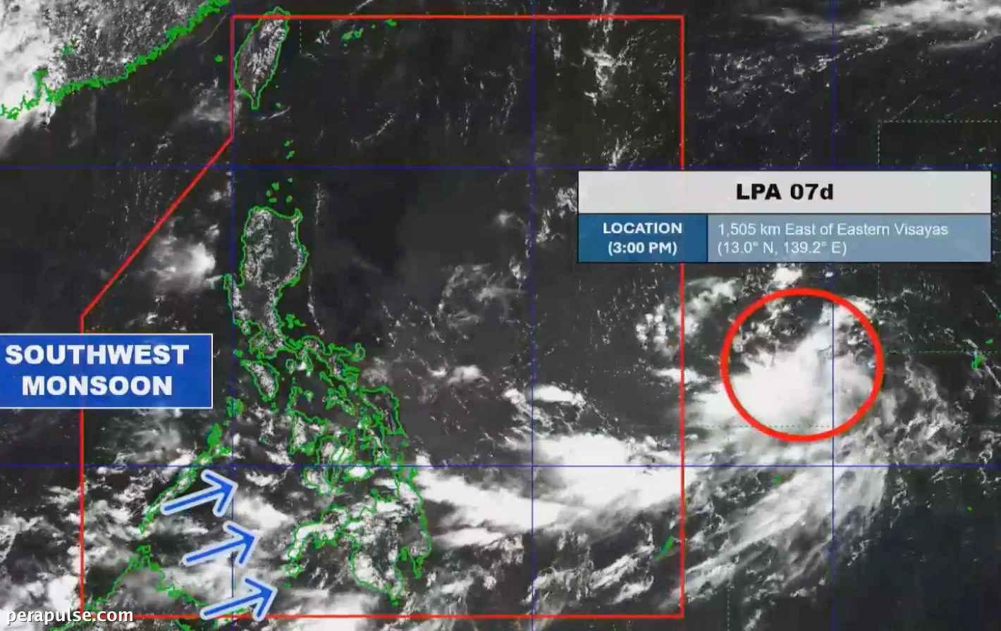
Nagbabala ang Philippine Atmospheric, Geophysical and Astronomical Services Administration (PAGASA) na ang isang low pressure area (LPA) na matatagpuan sa labas ng Philippine Area of Responsibility (PAR) ay malamang na umunlad sa isang tropical depression sa loob ng susunod na 24 na oras.
Noong Hulyo 21, ang LPA ay nakaposisyon ng humigit-kumulang 1,505 kilometro silangan ng Eastern Visayas. Inaasahan ng PAGASA na ang sistemang ito ng panahon ay maaaring pumasok sa PAR sa Hulyo 22.
Kung ito ay lalakas at pumasok sa PAR bilang isang tropical cyclone, ito ay bibigyan ng lokal na pangalan na Kiyapo, na kumakatawan sa water cabbage kung saan nagmula ang pangalan ng distrito ng Quiapo sa Maynila.
Posibleng Epekto sa Pilipinas
Ang potensyal na tropical cyclone na ito ay magiging ika-11 tropical cyclone para sa Pilipinas sa 2026 at ang ika-apat para sa buwan ng Hulyo.
Ang papasok na kaguluhan sa panahon ay maaaring umabot sa intensidad ng tropical storm. Ang pinakamataas na posibleng signal ng hangin para sa tropical cyclone ay Signal No. 2.
(cite: Benison Estareja, PAGASA Weather Specialist)
Ayon sa PAGASA, ang trough ng LPA ay maaaring magdulot ng mga kalat-kalat na pag-ulan at thunderstorms sa buong Eastern Visayas sa gabi ng Hulyo 21, na may karagdagang pag-ulan na inaasahan mula sa southwest monsoon.
- Inaasahang katamtaman hanggang malakas na pag-ulan (50-100 millimeters) sa Maguindanao del Norte, Sultan Kudarat, Sarangani mula Hulyo 22 hanggang Hulyo 23.
- Karagdagang pag-ulan na inaasahan sa Negros Occidental, Lanao del Norte, Lanao del Sur mula Hulyo 23 hanggang Hulyo 24.
Nagbibigay ng payo ang PAGASA sa mga residente sa mga apektadong lugar na maging alerto para sa mga update at gumawa ng mga pag-iingat laban sa posibleng pagbaha at pagguho ng lupa.