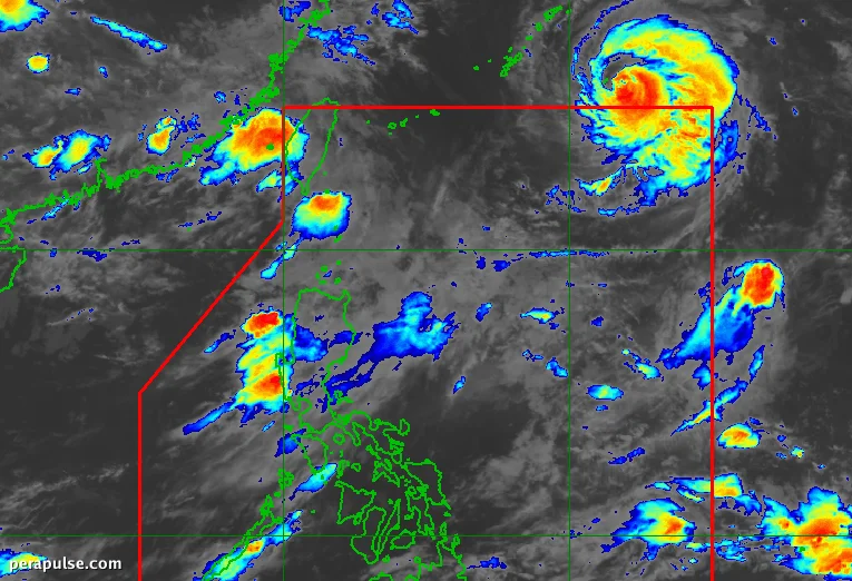
Typhoon Obet (Saudel) exited the Philippine Area of Responsibility (PAR) on August 24, 2026, but its impact is far from over. The storm is forecasted to bolster the southwest monsoon, leading to heavy rainfall across various regions in Luzon.
Current Status of Typhoon Obet
As of 3 AM on August 25, Obet was located 1,180 kilometers east-northeast of extreme Northern Luzon, moving west-northwest at 25 km/h. Its maximum sustained winds have weakened to 150 km/h, with gusts reaching 185 km/h.
Obet is noted as the Philippines' 15th tropical cyclone of the year and the fourth for August, following Tropical Depression Luis, Tropical Storm Maymay (Kujira), and Tropical Depression Neneng (Gaenari).
Obet is expected to enhance the southwest monsoon, bringing significant rainfall starting Tuesday, August 25.
Philippine Atmospheric, Geophysical, and Astronomical Services Administration (PAGASA)
Residents in affected areas should be prepared for potential flooding and landslides as these rains may cause hazardous conditions.
Monitoring Other Tropical Cyclones
Meanwhile, other tropical systems outside PAR have weakened. Atsani was downgraded to a tropical depression, while Neneng has reverted to a low-pressure area. Neither is expected to impact the Philippines significantly.