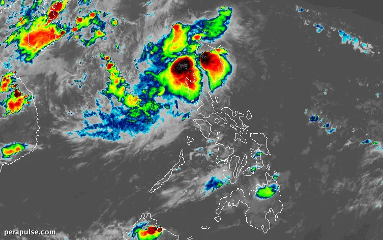
Tropical Depression Luis struck Maconacon, Isabela, at 5:30 PM on August 3, unleashing moderate to torrential rain across parts of Luzon.
Severe Weather Conditions Anticipated
As of 7 PM, the depression was still near Maconacon, moving west-northwest at 20 kilometers per hour. Winds reached up to 45 km/h, with gusts hitting 75 km/h.
The track of the tropical depression remains 'highly uncertain' and can still change.
Philippine Atmospheric, Geophysical, and Astronomical Services Administration (PAGASA)
PAGASA's latest rainfall advisory warns of potential flooding and landslides in affected areas. The southwest monsoon, or *habagat*, is also contributing to severe weather.
Forecast and Future Impacts
Luis is expected to weaken into a remnant low by August 4 and will likely be absorbed into Typhoon Dolphin, which is currently outside the Philippine Area of Responsibility.
As of 3 PM on August 3, Typhoon Dolphin was located 2,610 kilometers east-northeast of Northern Luzon. Though it poses no immediate threat, it is expected to enhance the southwest monsoon.
Luis is the Philippines' 12th tropical cyclone for 2026 and the first of August, with PAGASA predicting two to four more tropical cyclones could develop in the month.